[Rick] Since we did very little today except clean the boat, I will give you a little educational blog. Prepare to learn.
The Western Rivers. This term applies to the Mississippi, the Missouri, the Ohio, the Arkansas, and all the other rivers that basically flow into or parallel to the Mississippi. This term began in the early 1800’s when Lewis and Clark were exploring the west. At that time, these were, in fact, the Western Rivers. Nothing about California and the real west was known. So, these were charted, named, and rules were written for navigation. The term differentiates them from the eastern waters like the Hudson. Quick example of differences. On the western rivers, the buoys are red and green, but they are NOT numbered. On the East, they are red and green, but always numbered.
Dams, Wing dams, and Weir dams
 These are the three types of dams used on the western rivers. Dams are not used to control flooding. They exist for the sole purpose of making sure that the boating channel is deep enough for the commercial boating industry that uses the river to transport the nation’s grain, coal, and other materials. The traditional dam and lock systems make sure that the pool of water between the dams is at regulation depth. The Corps of Engineers also uses dredging on the lower Mississippi to make sure the channel is deep enough. On the lower Mississippi, the channel is guaranteed to be 45 feet. Since no large tanker can get past Baton Rouge, due to a low bridge, the guaranteed depth from Baton Rouge to the Ohio is 15 feet. On the Illinois River, the guaranteed depth is only 9 feet, and it takes 8 locks to do this over 300 miles of river.
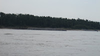 Wing Dams are various length stonewalls along both banks, more or less perpendicular to the channel, similar to a rock jetty. The purpose of the Wing dams is to make sure the current is forced to the center of the channel. This also prevents erosion of the river bank and a self flushing action that helps prevent shoaling.
 Weir Dams are rock sills located in the channel under the water, usually on a bend in the river. They are usually angled 20-30 degrees into the flow of the river. They are usually spaced 400-1400 feet apart and are 400-1600 feet in length. They are placed at an elevation that allows normal river traffic to pass easily over them. Their purpose is to assist in controlling the flow of water in the bend. They usually produce turbulence, and in some cases, a lot of it.
The Corps of Engineers is building these dams and structures to reduce dredging. Their goal is to eliminate dredging on the Mississippi, The Illinois, The Ohio, and the Missouri. A lofty goal to be sure…..
There you have it. Do you feel smarter???????

Explanation of a two chamber dam on the Illinois...
The Western Rivers. This term applies to the Mississippi, the Missouri, the Ohio, the Arkansas, and all the other rivers that basically flow into or parallel to the Mississippi. This term began in the early 1800’s when Lewis and Clark were exploring the west. At that time, these were, in fact, the Western Rivers. Nothing about California and the real west was known. So, these were charted, named, and rules were written for navigation. The term differentiates them from the eastern waters like the Hudson. Quick example of differences. On the western rivers, the buoys are red and green, but they are NOT numbered. On the East, they are red and green, but always numbered.
Dams, Wing dams, and Weir dams
 These are the three types of dams used on the western rivers. Dams are not used to control flooding. They exist for the sole purpose of making sure that the boating channel is deep enough for the commercial boating industry that uses the river to transport the nation’s grain, coal, and other materials. The traditional dam and lock systems make sure that the pool of water between the dams is at regulation depth. The Corps of Engineers also uses dredging on the lower Mississippi to make sure the channel is deep enough. On the lower Mississippi, the channel is guaranteed to be 45 feet. Since no large tanker can get past Baton Rouge, due to a low bridge, the guaranteed depth from Baton Rouge to the Ohio is 15 feet. On the Illinois River, the guaranteed depth is only 9 feet, and it takes 8 locks to do this over 300 miles of river.
 Wing Dams are various length stonewalls along both banks, more or less perpendicular to the channel, similar to a rock jetty. The purpose of the Wing dams is to make sure the current is forced to the center of the channel. This also prevents erosion of the river bank and a self flushing action that helps prevent shoaling.
 Weir Dams are rock sills located in the channel under the water, usually on a bend in the river. They are usually angled 20-30 degrees into the flow of the river. They are usually spaced 400-1400 feet apart and are 400-1600 feet in length. They are placed at an elevation that allows normal river traffic to pass easily over them. Their purpose is to assist in controlling the flow of water in the bend. They usually produce turbulence, and in some cases, a lot of it.
 The Corps of Engineers is building these dams and structures to reduce dredging. Their goal is to eliminate dredging on the Mississippi, The Illinois, The Ohio, and the Missouri. A lofty goal to be sure…..
There you have it. Do you feel smarter???????

Explanation of a two chamber dam on the Illinois...
Not necessarily wiser, but smarter! Thanks to the two of you for taking the time to share your experiences. I read it every morning.
ReplyDelete