[Rick] Not a lot today. The technician came this morning and we determined that we need a new throttle cable. We decided to replace both the throttle and shifter cable on the starboard motor. The tech did not have the cables and two were ordered from Nashville. Theyare to be here tomorrow.
We did finsh cleaning the boat.
Most of our looper friends did leave Green Turtle Bay today. They are proceeding up (even though they are going south) the Tennessee river. Remember, on the Western Rivers, if you are going against the current, you are NORTHBOUND and if you are with the current, you are SOUTHBOUND. There is no East or West. You are either going North or South. You may recall that the Legendary Delta Queen did not even have a compass onboard. In fact, due to the meandering nature of the Mississippi River, at one point we were going southbound, but the boat compass read due north.
We had been planning to go to Nashville. But, today, we decided to skip Nashville and concentrate our next month on the Tennessee River. We were in Nashvillle last year and still remember it quite well. On the Tennessee, we will go to at least Chattanooga and maybe further. We have a month before the AGLCA rendezvous in October which begins on the 25th.
More on the throttle tomorrow....
09-20-19 Green Turtle Bay Marina III
[Rick] Since we did very little today except clean the boat, I will give you a little educational blog. Prepare to learn.
The Western Rivers. This term applies to the Mississippi, the Missouri, the Ohio, the Arkansas, and all the other rivers that basically flow into or parallel to the Mississippi. This term began in the early 1800’s when Lewis and Clark were exploring the west. At that time, these were, in fact, the Western Rivers. Nothing about California and the real west was known. So, these were charted, named, and rules were written for navigation. The term differentiates them from the eastern waters like the Hudson. Quick example of differences. On the western rivers, the buoys are red and green, but they are NOT numbered. On the East, they are red and green, but always numbered.
Dams, Wing dams, and Weir dams
 These are the three types of dams used on the western rivers. Dams are not used to control flooding. They exist for the sole purpose of making sure that the boating channel is deep enough for the commercial boating industry that uses the river to transport the nation’s grain, coal, and other materials. The traditional dam and lock systems make sure that the pool of water between the dams is at regulation depth. The Corps of Engineers also uses dredging on the lower Mississippi to make sure the channel is deep enough. On the lower Mississippi, the channel is guaranteed to be 45 feet. Since no large tanker can get past Baton Rouge, due to a low bridge, the guaranteed depth from Baton Rouge to the Ohio is 15 feet. On the Illinois River, the guaranteed depth is only 9 feet, and it takes 8 locks to do this over 300 miles of river.
 Wing Dams are various length stonewalls along both banks, more or less perpendicular to the channel, similar to a rock jetty. The purpose of the Wing dams is to make sure the current is forced to the center of the channel. This also prevents erosion of the river bank and a self flushing action that helps prevent shoaling.
 Weir Dams are rock sills located in the channel under the water, usually on a bend in the river. They are usually angled 20-30 degrees into the flow of the river. They are usually spaced 400-1400 feet apart and are 400-1600 feet in length. They are placed at an elevation that allows normal river traffic to pass easily over them. Their purpose is to assist in controlling the flow of water in the bend. They usually produce turbulence, and in some cases, a lot of it.
The Corps of Engineers is building these dams and structures to reduce dredging. Their goal is to eliminate dredging on the Mississippi, The Illinois, The Ohio, and the Missouri. A lofty goal to be sure…..
There you have it. Do you feel smarter???????

Explanation of a two chamber dam on the Illinois...
The Western Rivers. This term applies to the Mississippi, the Missouri, the Ohio, the Arkansas, and all the other rivers that basically flow into or parallel to the Mississippi. This term began in the early 1800’s when Lewis and Clark were exploring the west. At that time, these were, in fact, the Western Rivers. Nothing about California and the real west was known. So, these were charted, named, and rules were written for navigation. The term differentiates them from the eastern waters like the Hudson. Quick example of differences. On the western rivers, the buoys are red and green, but they are NOT numbered. On the East, they are red and green, but always numbered.
Dams, Wing dams, and Weir dams
 These are the three types of dams used on the western rivers. Dams are not used to control flooding. They exist for the sole purpose of making sure that the boating channel is deep enough for the commercial boating industry that uses the river to transport the nation’s grain, coal, and other materials. The traditional dam and lock systems make sure that the pool of water between the dams is at regulation depth. The Corps of Engineers also uses dredging on the lower Mississippi to make sure the channel is deep enough. On the lower Mississippi, the channel is guaranteed to be 45 feet. Since no large tanker can get past Baton Rouge, due to a low bridge, the guaranteed depth from Baton Rouge to the Ohio is 15 feet. On the Illinois River, the guaranteed depth is only 9 feet, and it takes 8 locks to do this over 300 miles of river.
 Wing Dams are various length stonewalls along both banks, more or less perpendicular to the channel, similar to a rock jetty. The purpose of the Wing dams is to make sure the current is forced to the center of the channel. This also prevents erosion of the river bank and a self flushing action that helps prevent shoaling.
 Weir Dams are rock sills located in the channel under the water, usually on a bend in the river. They are usually angled 20-30 degrees into the flow of the river. They are usually spaced 400-1400 feet apart and are 400-1600 feet in length. They are placed at an elevation that allows normal river traffic to pass easily over them. Their purpose is to assist in controlling the flow of water in the bend. They usually produce turbulence, and in some cases, a lot of it.
 The Corps of Engineers is building these dams and structures to reduce dredging. Their goal is to eliminate dredging on the Mississippi, The Illinois, The Ohio, and the Missouri. A lofty goal to be sure…..
There you have it. Do you feel smarter???????

Explanation of a two chamber dam on the Illinois...
09-19-09 Green Turtle Bay II
[Rick] After the hard day yesterday, we slept in this morning. Did not do much during the morning. At 1100, we, and two other couples got the marina courtesy car and drove to Paducah, about 30 miles away. Our stated purpose was to see the National Quilting Museum. In reality, we just wanted to get off the boat for a few minutes.
We visited the River Museum in Paducah and found that they have a camera on their building recording the river, 24-7, and the tape goes back a week. We rewound to yesterday morning and sure enough, there are the 9 boats in our flotilla going by the Paducah waterfront. Quite unexpected and very interesting.
We visited the National Quilting Museum. Betsy and I have been there before on one of our river trips. It is a fascinating place. I cannot adequately describe the quilts here. Many were voted as the top 100 quilts in the 20th century. A special exhibit shows WOODEN quilts. Sounds crazy. But artisans carve and shape a piece of wood into the shape of a quilt, with folds, creases, etc. Then they carve designs on the wood. They finish by coloring the designs. It is amazing. One of the exhibits is WWII Bomber jacket and hat, made completely from wood. They did not allow photographs, so I have no pictures. However, if you are ever in the area, go to this museum.
 We returned to the marina in time for docktails at 1700. We joined about 30 people there, all talking about the loop and where they had seen each other. One of the couples, on board “Biddi and the Beast” (her name is Biddi, his is Dan but he does have a beastly look), crossed their wake and completed their loop today at this marina, so it was a celebration for them, as well as a birthday celebration for another looper. As the saying goes, “A good time was had by all”.
  Biddi and Dan, the couple that have completed the loop today.
09-18-09 Green Turtle Bay Marina, KY
[Rick] You would think that after a long 110 mile day on Wednesday and a 92 mile day on Thursday, that the 50 mile run on the beautiful Cumberland would be a breeze. NOT. Let me explain.
 We left the anchorage on the downstream side of Ohio Lock 52 at 0630 to lock through upon the locking of a tow. We waited about 45 minutes to get into the lock. The lock is old, poorly maintained, and very slow. We had to have 50 foot lines as we had to pass a line up to the lock person, loop around a bollard and then be raised about 13 feet. Did I mention that the lock is slow. So, for the 9 boats in our flotilla, we finally got out of the lock about 0900. We proceed up the Ohio River about 4 miles to Paducah, Ky.
 Paducah has a huge welcoming sign on the levee wall. However, there is only one 50 ft dock to tie, has a 15 minute time limit, and absolutely no services. It is a great old river town, but now does not cater to boaters at all.
 We proceeded up the Ohio to the mouth of the Cumberland River, about 15 miles. Upon entering the Cumberland, we encountered some strong current and turbulence. The current was 4-6 MPH against us. It stayed this was for the entire 32 miles up to Barkley Dam. Keep in mind that we are on one engine, since the throttle on one motor is not working. We could not use the autopilot to steer. We were trying to conserve gas, as we knew it would be close for us to make the marina. All in all, one of the hardest days we have traveled and one of the most tiring from fighting the current. We were not expecting the current to be so strong, and have been told that it is not normally this way.
We arrived at the Barkley Lock and Dam, were raised 60 feet and exited onto Lake Barkley and motored the mile distance to Green Turtle Bay Marina. This is a nice marina, charges only .75 per foot, yet we get all the amenities. They have free wifi, pool, cable TV, and decent restrooms and showers. They are a big sponsor of the AGLCA and we always try to patronize the looper sponsors. There are about 15 looper boats here, and for one couple, the end of the Great Loop. They are back home. We made arrangements for a technician to look at the throttle on Monday morning. We were glad to be tied up to a dock for the first time in 3 days, glad for a hot shower, and glad to be off the lower Cumberland River. 
 We left the anchorage on the downstream side of Ohio Lock 52 at 0630 to lock through upon the locking of a tow. We waited about 45 minutes to get into the lock. The lock is old, poorly maintained, and very slow. We had to have 50 foot lines as we had to pass a line up to the lock person, loop around a bollard and then be raised about 13 feet. Did I mention that the lock is slow. So, for the 9 boats in our flotilla, we finally got out of the lock about 0900. We proceed up the Ohio River about 4 miles to Paducah, Ky.
  Paducah has a huge welcoming sign on the levee wall. However, there is only one 50 ft dock to tie, has a 15 minute time limit, and absolutely no services. It is a great old river town, but now does not cater to boaters at all.
  We proceeded up the Ohio to the mouth of the Cumberland River, about 15 miles. Upon entering the Cumberland, we encountered some strong current and turbulence. The current was 4-6 MPH against us. It stayed this was for the entire 32 miles up to Barkley Dam. Keep in mind that we are on one engine, since the throttle on one motor is not working. We could not use the autopilot to steer. We were trying to conserve gas, as we knew it would be close for us to make the marina. All in all, one of the hardest days we have traveled and one of the most tiring from fighting the current. We were not expecting the current to be so strong, and have been told that it is not normally this way.
We arrived at the Barkley Lock and Dam, were raised 60 feet and exited onto Lake Barkley and motored the mile distance to Green Turtle Bay Marina. This is a nice marina, charges only .75 per foot, yet we get all the amenities. They have free wifi, pool, cable TV, and decent restrooms and showers. They are a big sponsor of the AGLCA and we always try to patronize the looper sponsors. There are about 15 looper boats here, and for one couple, the end of the Great Loop. They are back home. We made arrangements for a technician to look at the throttle on Monday morning. We were glad to be tied up to a dock for the first time in 3 days, glad for a hot shower, and glad to be off the lower Cumberland River.

Rick works the lines in the lock...
09-17-09 Lock 52 Ohio River
 Betsy speaks (seems like I always get the bad days!) What a long and miserable day this was! It started out OK, as we unrafted at the appointed hour 0700 and headed down the Mississippi. We enjoyed a gorgeous sunrise as we left our quiet anchorage in the diversion canal and entered the swift flowing river. Still staying closely to trawler Meander and sedan Still Busy, and not very far from the rest of the pack of nine boats total, we were cruising downstream at the breakneck speed of over 12 MPH…a record for Meander. We had approximately 5MPH current pushing us along, and we were easily getting well over 3 miles to the gallon of gas.
(Pictured to the left is "Still Busy" with newlyweds Jack and Pia Griffin from Charlotte, NC)
We met or overtook several barges along the way, the biggest of which was 6x6, for a total of 36 barges being pushed by one tow boat. After a slight altercation between one of the pleasure boaters and a tow captain yesterday, today’s tow pilots were super friendly and in fact complimented us on our professionalism as we headed down. As the caboose of the pack, we generally would call the barge to let them know we were the last pleasure craft in this bunch and they were all very appreciative.
We hit the junction of the Ohio River and the Mississippi at about lunch time, and our speed was cut in half immediately. We have to travel upstream on the Ohio for about 70 miles altogether, and did about 45 miles of that today. Now we are heading into a current of about 2 MPH, and also into a strong headwind. We’ve had a little trouble with the starboard throttle ever since the beginning of the trip, and in fact had it adjusted while we were in Virginia. Over the past several days it has really started acting up again, and at times I had to use both hands full strength to pull it back. We planned to have it looked at again this coming Friday once we arrived at a full service marina, but in the meantime it had gotten so bad that I tried to make an adjustment on it today. The last guy that worked on it showed us how to simply adjust a screw to loosen it up, so I tried that today. At first I couldn’t tell adjusting the screw made any difference, and all seemed well. Then we entered a lock and things went bad. This locking experience would have been bad even with a good throttle, though. The lockmaster had all nine boats come into the lock, but he told us to just drift in the lock rather than secure ourselves with lines. He assured us there was plenty of room to maneuver…wrong!!! I don’t think anyone ran into anyone else, but it was
  extremely nerve-wracking trying to hold position in a very confined area with the wind blowing and a boat in front and one in back of us also trying to maintain position. We all started out in a straight line as seen in the pictures here, but by the end it was chaos. It seemed like it took forever for us to rise the 6 feet…we didn’t time it but surely it was 30 minutes. About midway through I realized that the starboard throttle was doing basically nothing, so I was maneuvering with only one engine.
 As we finally pulled out of the lock and tried giving it gas, nothing happened. We turned it on and off several times, made sure nothing was fouling the prop, made sure water was pumping through it, tried readjusting the screw in the throttle, all to no avail. Finally we turned it off and went the rest of the way to today’s anchorage, about 20 miles, on one motor.
Up until then, we were confident that we did have enough gas to make it this 250 mile run we’ve been concerned about. Staying with our two companion boats at trawler speed, we would have had a range of at least 400 miles. Now on one motor it looks like we will just barely make it to our next fuel stop, 40 miles away tomorrow. We have two gas tanks, and with only one motor working, we are only drawing out of one tank, with no way to siphon gas out of the other tank. Fortunately there is a Towboat US operator at our next fuel stop, so if we don’t make it we will be towed at no charge, since we are members of Towboat US as well as SeaTow.
So much for that bad news. Now let’s talk about Beamer! It was such a pain to get her to shore yesterday that we decided not to try that again. She would just have to go on the boat. We’ve learned that dogs can go for up to 72 hours without relieving themselves, and that they will never hold it in so long that they cause any damage. So Beamer went all day long today with no bathroom stop, and the amazing thing is she never showed any distress…no whining, nothing. Finally about 5 o’clock this afternoon we came upon a tiny floating dock at a state park, so we pulled over to it and let her off the boat. Needless to say she was relieved (as were we). We knew about this possible stop thanks to one of our cruising guides, and it was just a couple of miles from our final anchorage for tonight so it worked out well. The cruising guides aren’t always right, so we were glad to see this was a good stop. Tonight we are rafted up again, though not as tightly as last night. There are still nine of us, but we have a lot more room than we did last night Several boats are individually anchored, and several are rafted up just two or three boats. We are rafted to Meander, and were pleased to have a home cooked meal on their boat tonight…Chinese, delicious. Thanks Marji! Meander is pictured at left.
Our anchorage is right before our 2nd lock on the Ohio, and we will plan to go through that lock hopefully about 7:15 tomorrow morning. The lockmaster is expecting us and unless there is a pile up of barges during the night we should be able to go right in. Unfortunately it’s going to be another float around the middle type again. This time we’re going to insist on being in the back so we’ll have more room to maneuver with our one engine. I think all the other boats that have only one engine have bow thrusters, so we’re definitely at a disadvantage.
So as you read this Friday morning, say a little prayer that we make it to the marina safely tomorrow afternoon. We have about 50 miles to go.
09-16-09 Diversion Canal – Cape Girardeau, MO
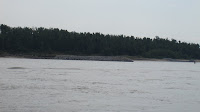
[Rick] The great migration from Hoppie’s Marina in Kimmswick, MO to the Green Turtle Bay  Marina in Tennessee began this morning at 0700. Nine boats, of all sizes and types left in convoy for the 110 mile trip to the Diversion Canal in Cape Girardeau, MO. The Diversion canal funnels the rainwater runoff from the city back to the Mississippi. Once again it was kind of slow, by our standards, since we have agreed to stay with the trawler, Meander, and the sedan, Still Busy. With the current we averaged about 11 mph for the day. For Meander, this was the fastest she has ever been through the water. Here is the view Betsy and I had all day as we made the trip.
 Along the way, we passed Cape Girardeau, MO. We had visited this town before when travelling on the legendary Delta Queen (on her final cruise, in fact), and unfortunately, there is no place to stop and tie here. They do have some beautiful murals on the levee walls. I remember this as the hometown of its most famous citizen, Rush Limbaugh (this is for you, bro Steve). There is a huge picture of Rush on the levee wall, along with many historic scenes of the town on a long mural.
 Arriving at the Diversion Canal, we had to raft up for everyone to get in. This process involves the boats being tied to each other, with several anchors deployed. The canal has no current, so that is a big help. We managed some pictures of the raft up. Being the next-to-smallest boat, we always get to raft up on the outside of the bigger boats, and we do not put out an anchor.
 Marina in Tennessee began this morning at 0700. Nine boats, of all sizes and types left in convoy for the 110 mile trip to the Diversion Canal in Cape Girardeau, MO. The Diversion canal funnels the rainwater runoff from the city back to the Mississippi. Once again it was kind of slow, by our standards, since we have agreed to stay with the trawler, Meander, and the sedan, Still Busy. With the current we averaged about 11 mph for the day. For Meander, this was the fastest she has ever been through the water. Here is the view Betsy and I had all day as we made the trip.
 Along the way, we passed Cape Girardeau, MO. We had visited this town before when travelling on the legendary Delta Queen (on her final cruise, in fact), and unfortunately, there is no place to stop and tie here. They do have some beautiful murals on the levee walls. I remember this as the hometown of its most famous citizen, Rush Limbaugh (this is for you, bro Steve). There is a huge picture of Rush on the levee wall, along with many historic scenes of the town on a long mural.
 Arriving at the Diversion Canal, we had to raft up for everyone to get in. This process involves the boats being tied to each other, with several anchors deployed. The canal has no current, so that is a big help. We managed some pictures of the raft up. Being the next-to-smallest boat, we always get to raft up on the outside of the bigger boats, and we do not put out an anchor.
 Once we got tied up and settled, Jimmy on Riff Raff deployed his dingy to take the dogs from Pookie II to the shore for the daily business meeting. Jimmy, then, took Betsy and Beamer to the shore to attend the same meeting. The meeting adjourned with no tangible output and Jimmy brought everyone back to the boats.
Tomorrow, we leave at first light for Paducah, KY. 90 miles and 2
 locks away.
Betsy adds: Regarding the dogs: Jimmy’s dinghy is tiny and he has a 2.5 horsepower motor. He carried Evan from Pookie II along with his two medium sized dogs all the way across the Mississippi to the opposite shore where there was a sandy beach to step off onto. But the current was fierce and it was quite a chore for him. So when he came back to get Beamer and me, I said let’s just go to the bank where the canal meets the river…there was a large rocky area there at the conversion of the waters, and it looked like if I could get off the dinghy onto the rocks I’d be able to make it up a hill with Beamer to an area with greenery. We carried Beamer in her softsider carrying case…remember she is a psycho dog that doesn’t get along too well with other people and I felt this was the best way to handle her in the dinghy. At first I put one foot off the dinghy and sank ankle deep into the mud (I had on my shower Crocs). So Jimmy took me a little closer to the rocks and I stepped out again and then lifted Beamer, in her case, off the dinghy. Once I got my footing Jimmy left to go all the way across the mighty and swift Mississippi to pick up Evan and his dogs. I let Beamer out of her case and we worked our way up the rocks until the ground was a little more firm. Problem was my Crocs were full of mud so even on rock or firm ground I was very unsure of my footing as I was slipping inside the shoes.
Beamer pee’d plenty, but would not do the serious business. Finally Jimmy got Evan and his dogs back across the river and back to their boat, then came to get us. I had put Beam back into the case and handed her into the dinghy, then carefully climbed back in myself. Once back to the raft-up, Evan was there with hose ready to wash the mud off my feet before I stepped onto the boats. As I write this, poor Beamer is banned to the back of our boat because Mississippi Mud is still caked to the bottom of her feet. Tomorrow we will work on training Beamer to “go” on the boat like some of the other dogs do. We made a feeble attempt at this last year, but now it is going to be a necessity, because I’m not dinghying her to shore again!!
09-15-09 Hoppies Marina Kimmswick, MO
[Rick] Today was a make or break kind of day. We left Alton Marina, the nicest marina we have encountered on the trip, for Hoppie’s Marina. We will be travelling with the trawler Meander, and the Carver Still Busy. Our task is to verify that we can make it 250 miles to the next gas stop. Meander, the trawler, only goes about 8 mph, but the Mississippi has a good following current, so at times, today, we were doing 11.2 mph. We ran with only one motor, following Meander and managed to average 3.28 miles per gallon (at times we were up to 6 MPG!). This convinced me that we can do the next part of the trip, the 250 miles, with very little worry. But, to be on the safe side, we will travel with these two boats until we reach Kentucky Lake and refuel.
 When we left the marina, we added 4 more boats to the flotilla that were coming from Grafton Marina. We were strung out like a convoy. We all went through the two locks together. We passed the confluence of the Mighty Missouri River, aka the Big Muddy, and passed St Louis with its famous Gateway Arch. It was wonderful to have the current behind us pushing us along. When the Missouri intercepted the Mississippi, the increase was over 2
  mph immediately.
 We all arrived at Hoppie’s Marina in Kimmswick, MO and topped off our tanks. This is a marina in the loosest sense of the word. It is really 3 floating barges, tied together, and secured to the shore. Then, other floating “docks” were added and strung along. They do have Gas and Diesel. The owner, Fern Hopkins, gave an information talk at a captain’s meeting regarding places to anchor out and places to avoid for the next 250 miles. As crude as it is, it
  is a must stop for every looper and its reputation preceded it. This is one of the places we’ve heard about every since we started thinking about doing the loop. Not only is it the last gas stop but owners Fern and Hoppie Hopkins are colorful characters. Here is a picture of Fern with Betsy and Fern's husband, Hoppie.


Jimmy and the Levee High Apple Pie.
 When we left the marina, we added 4 more boats to the flotilla that were coming from Grafton Marina. We were strung out like a convoy. We all went through the two locks together. We passed the confluence of the Mighty Missouri River, aka the Big Muddy, and passed St Louis with its famous Gateway Arch. It was wonderful to have the current behind us pushing us along. When the Missouri intercepted the Mississippi, the increase was over 2
  mph immediately.
  We all arrived at Hoppie’s Marina in Kimmswick, MO and topped off our tanks. This is a marina in the loosest sense of the word. It is really 3 floating barges, tied together, and secured to the shore. Then, other floating “docks” were added and strung along. They do have Gas and Diesel. The owner, Fern Hopkins, gave an information talk at a captain’s meeting regarding places to anchor out and places to avoid for the next 250 miles. As crude as it is, it
  is a must stop for every looper and its reputation preceded it. This is one of the places we’ve heard about every since we started thinking about doing the loop. Not only is it the last gas stop but owners Fern and Hoppie Hopkins are colorful characters. Here is a picture of Fern with Betsy and Fern's husband, Hoppie.
We walked into town, and it turned out to be a treat. This is apple country, and everywhere, they had apple related products to sell. The stores are old, and small. Jimmy Tant on Riff Raff, paid $35 for a 9 pound apple pie, called the “levee high pie” because of its odd shape. He later shared it with us after supper. Here are some random pictures of the town and the day.


Since we are anchoring out the next two nights, we may or may not have access to cell phone and/or internet signals. So, check back. We will post as soon as possible.
Jimmy and the Levee High Apple Pie.
Subscribe to:
Posts (Atom)